 PeteFree.com
Blodgett Peak (Colorado Springs) Route Guide Links
© 2011 Peter Free
03 August 2011
Three of the better URLs for information about hiking Blodgett Peak in Colorado Springs, Colorado
Route from Colorado Springs (Woodmen Road) Side
Route from Air Force Academy Side
General comments on the Academy side Blodgett Peak route
This route is significantly longer and more complicated than the City trail and it is easier to take a wrong turn. Carrying a compass may save you some unnecessary effort.
Surprisingly, until one gets to Blodgett’s north ridge, the trail is less appealing than the City-accessed route. Evidence of human activity is everywhere, including eye-catching power lines, numerous steel water culverts, fence posts, and decomposing electrical cable.
The route is also annoyingly (and sometimes unnecessarily) circuitous. People who use Blodgett Peak as a two-hour conditioning exercise will be happier on the east (City) side.
Route notes for the Academy side trail
Mike Mc’s route guide at the SummitPost URL is very good.
Here are my 02 August 2011 clarifications to his 07 August 2006 route description:
(1) From the Academy parking lot that Mike describes, you will intersect the Falcon Trail as he indicates. But the signs are white plastic vertical strips today, and the logo is brown. There is no number on the sign that he points you to.
Mike forgot to tell hikers to turn left onto the Falcon Trail (east and downhill) from the dirt parking lot road, rather than right and uphill.
(2) The four wooden utility poles he describes as marking the turn from Falcon Trail onto the route toward Blodgett Peak are on the east end (far side) of the “clearing.” You won’t see them until you are almost on top of them.
Additionally, there is metal sign for Forest Service Trail 713 at that intersection (not later, as his description implies).
(3) Mike’s “stone arrow pointing east” is a collection of granite rocks that have been laid on the ground to make a confusingly-shaped arrow. It points toward the right-hand (as you face uphill) fork in the trail.
The tail on this arrow is overly long, curved, and initially looks more like a water-diverting arrangement than an arrow.
I mention my confusion because your natural hiking instinct will probably imitate mine. Your inertia want to take you left, not right at this intersection. That is because the incorrect left fork goes uphill and curves directly in the direction of Blodgett Peak. The correct right-hand fork appears initially to go in the wrong direction.
I initially made the mistake of not recognizing the arrow as a pointer and going left instead. The left fork trail eventually takes you out onto two dangerously steep gravel traverses along the precipitous canyon. These traverses are hazardous enough that I turned back after completing two of them.
(4) Once over the intermediate “pass” that Mike describes, you’ll see the “jeep trail” he refers to.
(5) The 713 trail traverses down to the jeep road.
Be sure to mentally note the intersection of the trail and the jeep road. If you don’t, you will likely walk by it on your way back.
Mike omits telling you to go uphill (rightward as you face the jeep trail) to find the brick-colored water tank. The tank is steel, industrial-sized, and can’t be missed. But you won’t see it, until after walking around a few curves in the jeep road.
(5) Once at the water tank, you will see a steel-grated walking bridge that spans a concrete culvert which parallels the jeep trail. Cross the bridge and walk along the east side of the tank.
On the day I was there, a small brook was running adjacent to the concrete tank base.
About mid-circumference on the east side of the tank, you will see a narrow trail leading uphill. It is the first path that you come to on that side of the tank. This is the beginning of the “gravel ridge” that Mike describes as being Blodgett’s North Ridge.
Note 1
The Ridge has decomposed gravel lying atop dirt. And this begins the slippery challenge that Blodgett poses for joint-diseased people.
Note 2
Make a mental note that this narrow path (on the east side of the water tank) is actually one fork of the two terminal prongs of the North Ridge trail.
The other fork, the wider one, is just a few yards beyond it and out of sight.
When you come back down from the peak, you will probably wind up on the wider prong near the tank because it follows the natural contour of land.
However, if you do wind up on the wider prong, you may find yourself having to wade a wider part of the brook that runs around the water tank in wet conditions. In that event, you may stay drier if you backtrack uphill a few yards and look for the narrower fork that you took on your way up. It crosses the narrower part of the small stream.
(6) Mike doesn’t mention the difficulty that lies in successfully following the “alleged” trail to the peak.
I highlight this because inclement weather can rob hikers of the far-away landmarks that we customarily use to orient ourselves. The day I was on the route, the weather was clouded-in and raining.
The trail is poorly marked (and not at all maintained) in quite a few places. And it doesn’t always follow the route that experienced wilderness travelers would probably take.
As a result, some people have built small cairns to mark the way. But they appear to have done so only after losing the trail.
Consequently, many of the cairns don’t belong to the same route that other cairns mark. And the impromptu rock piles (even when they do mark one route) are usually too far apart to be seen from one to the other.
This disjointed aspect makes sense, when one realizes that virtually no one is going to go back down to see the last cairn they passed and then build a new one within sight of it.
So be prepared to bushwhack in the general uphill direction, occasionally casting back and forth to find visible signs of the path.
Throughout the North Ridge portion of your hike, pay especially good attention to the geomorphological orientation of the ridge. If you go down the away-from-the-Academy side, you’ll wind up in a difficult drainage far from where you want to be.
If you inadvertently go down the precipitous closest-to-the-Academy side, you’ll be risking your life.
When in doubt, stay on the highest portion of the ridgeline.
I had to bushwhack west and south to find the more visible Colorado Springs-side trail in order to get the last few hundred feet up to the summit.
(7) In wet weather, beware the lichen-covered granite rocks and outcrops that occasionally line the route. Wet lichens are slippery as ice.
No matter how fit you are, or how experienced, if you spend much time on these rocks in wet weather, you will slip in ways that catch you by surprise.
(8) Related to my warning about the granite outcroppings is the fact that the trail does not stay on a consistent side of these.
In some places it stays on the precipitous Academy side edge. In others, it deviates toward the safer side. In some cases, I found it difficult or impossible to be sure which way the path went.
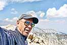
(9) The peak itself is a small agglomeration of granite boulders. Some move. When dry, they’re fine. When wet, they get your attention quickly.
(10) For people with ailments, going down the ridge to return to the Academy is probably more comfortably done with trekking or ski poles. I had to improvise two from fallen branches to get my decrepit joints successfully downhill.